
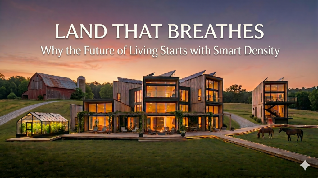
How We Build 4x More Affordable & Efficient Neighborhoods While Leaving 75-90% of the Land Untouched For All Time.
HOW SMART DENSITY WORKS
The Physics of Land That Breathes
There is a moment, standing on undeveloped land in New England, when the noise of planning falls away. No zoning diagrams, no subdivision grids, no renderings of what might be imposed. Only trees, soil, wind moving through uneven ground. The land feels complete—alive in its own slow, intricate language. And then the question arrives, almost uninvited: what happens to this place when we build on it—not just what gets built, but what gets lost?
For most modern development, that question comes too late. The logic begins with division. An acre becomes lots. A field becomes access roads. Forest edges become setbacks. Space is consumed until continuity survives only in fragments between driveways and lawns. The houses remain technically separate, but environmentally continuous in their disruption—each requiring its own clearing, its own systems, its own footprint of removal. We call it development. Often, it is replacement.
Smart density is the structural correction to this pattern. It is an approach to planning that prioritizes the efficient use of land, minimizing environmental impact while promoting sustainable living. It proves that housing density does not require landscape destruction; rather, it is a consequence of layout and distribution. When density is reorganized and folded inward rather than expanded outward, the land does not disappear. It reappears.
At BIOS Homes, this premise transforms development from land consumption to land configuration through precise strategies:
-
Footprint Compression: Instead of distributing dwellings evenly across a parcel, housing is clustered into compact groups. Built form tightens, taking up a fraction of the lot—such as compressing the residential area onto just 25% of an acre—while the remaining 75% stays continuous. The home occupies only what it requires, leaving the majority of the land entirely unbuilt to remain a functioning landscape.
-
Shared Infrastructure: On a conventional acre, four houses sit apart, each with grading, access, utilities, and duplicated infrastructure, turning the entire site into a managed surface. Smart density gathers those same four homes into a shared footprint. Infrastructure and utility networks are consolidated into a single loop, which cuts costs and keeps the surrounding land continuous and ecologically intact.
-
System Continuity: Because the built environment contracts, the surrounding landscape is allowed to breathe and function as an active system. Forest remains forest. Water continues along existing paths instead of being repeatedly interrupted by isolated construction footprints. Wildlife corridors, air movement, and natural gradients remain connected rather than segmented into isolated pockets.
This is architecture as spatial decision-making. A house is no longer only an object placed on land; it is part of a configuration that either fragments or preserves what surrounds it. By adopting these principles, communities can maintain identical housing yields while shrinking their environmental footprint, creating spaces where human habitation and ecological continuity live right alongside each other.
Land use is not a design problem—it is a system of rules
Housing is often treated as a design question: where to build, how much to build, what form it should take. In practice, none of those decisions come first. Before architecture enters the conversation, land has already been shaped by regulation. Zoning codes, setback requirements, minimum lot sizes, wetlands protections, and planning processes form an invisible framework that defines what land is allowed to become. Each rule is rational in isolation. Together, they produce a default outcome: fragmentation.
In Connecticut and much of the United States, land is pre-shaped long before it is designed. Developers inherit this structure. Forests are cleared because they fall within buildable envelopes. Roads extend further than necessary because each parcel requires access. Systems are duplicated because the code assumes isolation. The result is familiar: low-density expansion that consumes more land than necessary while delivering less of what is increasingly desired—proximity to the living world.
Spatial Efficiency Analysis (1-Acre Footprint)
| Metric | Traditional Subdivision Model | BIOS Clustered Village Model |
| Families Housed | 4 Families | 4 Families |
| Structural Layout | 4 Fragmented, detached luxury estates | 1 Clustered, shared architectural footprint |
| Land Disruption | 100% (Clear-cut, stripped surface) | 25% (Compressed built form area) |
| Infrastructure Strain | 4 Independent septic systems | 1 Consolidated, shared ecosystem loop |
| Permanent Preservation | 0% Open Space | 75% Preserved Functioning Landscape |
The tension is real. Housing advocates point to affordability constraints created by restrictive zoning. Local officials point to infrastructure limits and the preservation of community character. Both are correct. The deeper issue is not intent—it is configuration. The question is no longer only how much we build, but how land is arranged in the process of building it.
THE FIRE OF CONSTRAINT
THE CHOSEN CANVAS
The overlooked land already waiting in plain sight
Across towns and suburbs, the most overlooked land is not empty—it is misaligned. Irregular parcels, narrow infill gaps, sloped or fragmented sites that resist standard subdivision logic. Conventional development avoids them because they require adaptation. Adaptation introduces friction. So they remain unused.
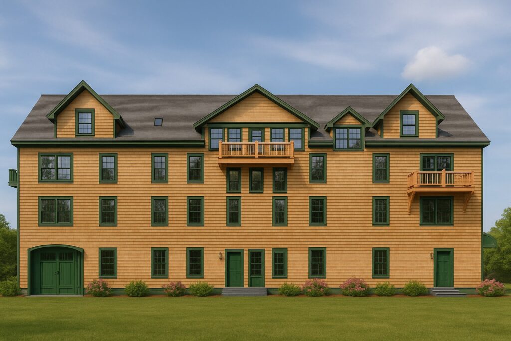
Precision modular systems invert that logic. Land is no longer forced to conform to housing. Housing conforms to land. Structures step with slope, adjust to boundaries, and respond to existing conditions. What was marginal becomes viable. Infill replaces expansion. Reactivation replaces consumption.
A deeper shift is also underway. After years of digital saturation and indoor living, many people are seeking something more grounded—without abandoning modern design or comfort. The demand is no longer for either urban efficiency or rural depth, but for both. The clustered model makes that possible. This comprehensive framework comes together entirely within the BIOS Village, a master-planned ecosystem where individual infrastructure demands are consolidated into shared, high-performance networks. Within this closed-loop environment, localized Water engineering loops handle decentralized purification on-site to protect local aquifers, while community-scale Food production is woven directly into the residential grid through agrivoltaic greenhouses and permaculture gardens. The Shelter itself is constructed as a high-design, precision modular envelope using carbon-capturing, non-toxic materials like hemp and bamboo, powered continuously by a localized microgrid Energy network of coordinated rooftop arrays and thermal storage. Rather than letting the surrounding landscape sit idle, the community activates its open acreage through BIOS Farms and Equestrian Developments, integrating contemporary modular barns, managed paddocks, and restorative agriculture directly into the village footprint. By organizing development around these interconnected resource streams rather than duplicated utility lines, the architecture systematically eliminates the environmental and psychological friction of modern sprawl—restoring a profound sense of Peace by allowing human communities to exist in absolute harmony with the living landscapes that sustain them. What emerges is not nostalgia for rural life, but a structural integration of architecture, agriculture, and ecology. Homes no longer sit on land. They participate in it.
THE HORIZON